News Summary
Residents of northwest Louisiana should prepare for severe thunderstorms and heavy rain expected to hit the area starting Thursday morning. The National Weather Service has issued warnings about strong winds and potential flooding, urging motorists to exercise caution while traveling. Rainfall totals may range from half an inch to an inch, with localized areas experiencing heavier downpours. While the storms are expected to ease by Friday morning, scattered showers may return over the weekend as temperatures fluctuate. Staying updated on local weather conditions is crucial for safety.
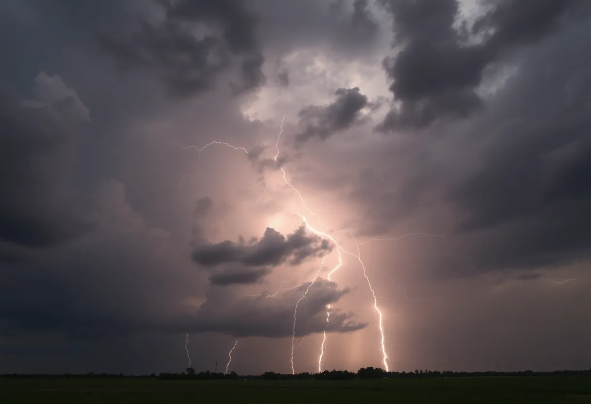
Severe Thunderstorms and Heavy Rain Headed for Northwest Louisiana
It was just another calm day in northwest Louisiana, but residents should brace themselves as something much stormier is on the way. Today, the area is gearing up for a fierce bout of severe thunderstorms paired with heavy rain that could complicate outdoor plans for many. The forecast is calling for downpours that might not just drench the ground but also lead to potential flooding and some pesky patchy fog, especially when night falls.
Timing and Expectations of Storms
The National Weather Service (NWS) based in Shreveport has laid out an alert that storms will ramp up early Thursday morning. This weather system is expected to stick around right through midday. So, if you had any plans to be out and about, you might want to reconsider as the rain is projected to bring rainfall totals between half an inch to one inch. However, those living in localized areas could find themselves dealing with even heavier rain.
Travelers Beware!
For motorists, especially those traveling on I-20 and nearby highways, it’s crucial to exercise caution. The combination of heavy rains and winds means visibility will be reduced, and the roads could become quite slippery. So, buckle up and give yourself extra time to reach your destination safely!
Potential Risks and Precautions
As if that isn’t enough, the storms are also expected to bring strong winds and possibly even isolated severe weather conditions late Thursday night. This poses a risk of power outages and minor flooding in low-lying areas, so residents should be prepared. It’s a good idea to secure any outdoor items that could become projectiles in a wind gust and make sure your emergency kits are up to date.
Looking Ahead: A Breather from the Storms
On a brighter note, the forecast indicates that the risk for severe weather is likely to ease up by Friday morning, revealing a refreshing change. After the stormy night, residents can look forward to partly sunny skies later in the day, although temperatures will start at a cool high of 69 degrees, dipping to a chilly 47 degrees overnight.
Weekend Outlook
But don’t pack away the rain gear just yet! There might be scattered showers and thunderstorms making a comeback on Saturday. However, those looking to enjoy some Sunday fun can anticipate beautiful sunny weather to wrap up the weekend. As we head towards New Year’s Eve, the skies are expected to clear up with a pleasant high near 57 degrees. Perfect timing for those late-night celebrations!
Final Thoughts
As the storm system approaches, it’s wise for residents to keep an eye on local weather updates to stay informed. The key is to be prepared and stay safe! Make plans accordingly, and if you’re traveling today, allow extra time for any possible delays while remaining apprised of the current road conditions. Let’s hope everyone comes through this weather event with the sun shining bright once again!
Deeper Dive: News & Info About This Topic
HERE Resources
Severe Weather System to Strike Southern U.S. This Weekend
Severe Storms and Tornado Threat Loom Over Southern U.S. This Holiday Weekend
Severe Thunderstorms to Sweep Across East Texas, Louisiana, and Southwest Arkansas: Residents Advised to Stay Alert and Prepared
Northwest Louisiana Prepares for Severe Thunderstorms
Wet Christmas Forecasted for Shreveport and Bossier City
Additional Resources
- Country Herald: Shreveport Travel Advisory
- Wikipedia: Severe Weather
- Shreveport Times: Tornado Warning
- Google Search: Severe Weather Alerts
- KTAL News: Flash Flood Threat
- Google Scholar: Weather Alerts in Louisiana
- NOLA: Weather Forecast Louisiana
- Encyclopedia Britannica: Natural Disasters