News Summary
Heavy rainfall caused devastating flash floods in Shreveport and Bossier City, leading to road disruptions and a school bus getting trapped in floodwaters. Despite strict protocols, residents faced unpredictable hazards as floodwaters submerged numerous vehicles. As the community prepares for further storms, officials are distributing sandbags to residents. The rise in water levels in the Red River basin adds additional concern for local areas, with flood warnings on the horizon. The unpredictability of flash floods emphasizes the need for residents to stay informed and remain cautious.
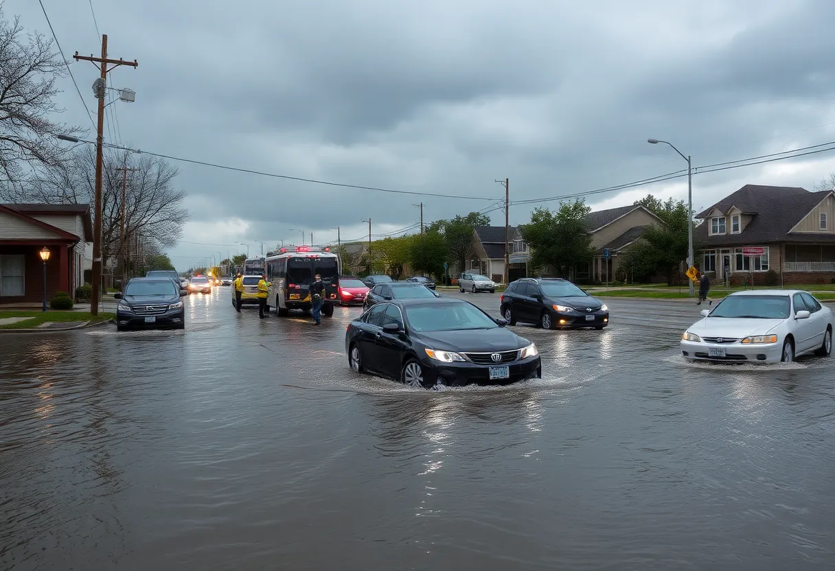
Shreveport – Flash floods hit Shreveport and Bossier City this past week, affecting roads and disrupting travel for drivers. The heavy rainfall resulted in significant flooding in both cities on two separate occasions, prompting concerns for those navigating flooded roadways.
In one incident, a Caddo Parish school bus became trapped in floodwaters while making its way down Youree Drive before East Washington Street. According to Caddo School officials, the bus driver had followed other vehicles into the water but lost control and veered off the roadway. Fortunately, both the driver and the lone student on board were unharmed, and the bus has since been inspected and returned to service. Notably, school officials emphasized that their protocols generally prohibit drivers from traversing impassable water, especially when roadways are closed, though no official road closures were in effect before or after this incident.
The Louisiana Department of Transportation and Development (LADOTD) highlighted that flash floods are inherently unpredictable, making it challenging to formulate effective flood mitigation strategies. Just days after the school bus incident, further storms caused repeat flooding events in the area. Particularly severe conditions were reported on Tuesday when several cars parked on Centenary Boulevard at Olive Street were submerged despite the area being classified as a minimal flood zone by FEMA.
Another stretch of concern is Youree Drive, which runs from East Washington to Kings Highway and is identified as a flood zone. During storm events, floodwaters from East Washington funnel into Pierre Bayou, which tends to rise rapidly, thereby increasing the flood risk for nearby neighborhoods. Drivers also experienced complications due to extensive flooding on Old Minden Road in Bossier City. A flooded intersection at Benton Road forced many motorists to either turn around or risk navigating through standing water.
Detours such as Airline Drive aimed at Barksdale Boulevard faced similar flooding challenges, leading to further delays and difficulties. LADOTD issued a reminder that any road can potentially flood and urged drivers to remain patient and turn back when necessary to avoid hazardous conditions.
In anticipation of ongoing bad weather, Shreveport officials began offering sandbags in preparation for potential severe conditions expected on May 5. Residents can pick up 15 sandbags per vehicle on a first-come, first-served basis at designated locations. Additional sandbag distribution is planned for Caddo and Bossier Parishes, with specific times announced for community pickups.
Last week’s severe storms left a trail of extensive flooding throughout Shreveport and Bossier City, resulting in stalled vehicles and emergency rescues. There is further concern regarding rising water levels in the Red River basin, which incorporates areas upstream, contributing to the flood risk in the region. The National Oceanic and Atmospheric Administration (NOAA) flood gauge in Shreveport recently reported the Red River at 25.24 feet as of May 5. This level is less than a foot below the “Action” level of 26 feet, indicating the river is approaching flood stage.
Forecasts suggest that the Red River may reach flood stage by Thursday, influenced by both upstream rainfall and localized precipitation. Video footage from various sources has depicted the Red River overflowing its banks at the I-35 crossing on the Texas-Oklahoma border, raising alarms about the increasing potential for downstream flooding.
As the community braces itself for these unpredictable weather patterns, officials remind residents to stay informed and prepared as the threat of further flooding looms.
Deeper Dive: News & Info About This Topic
HERE Resources
Record Rainfall Causes Severe Flooding Across Mid-South
Severe Tornado Outbreak Causes Widespread Destruction Across U.S.
Shreveport Residents Assess Damage After EF1 Tornado Hits Neighborhood
Severe Weather Alert: A Weekend of Storms Ahead!
Devastating Flooding Hits Kentucky and West Virginia
Storm Delivers a Wild Ride Across Southern California
Southern California Faces Strongest Storm of the Season
Southern California Braces for Powerful Storm
Winter Weather Alert: Two Major Storms Expected
Tornado Strikes Monroe, Louisiana, Leaving Damage Behind
Additional Resources
- KTBS: Flash Floods Overwhelm Street Drainage in Shreveport-Bossier City
- KSLA: Free Sandbags Being Offered by City of Shreveport
- KEEL: Red River Rising Flood Threat
- Shreveport-Bossier Advocate: Flash Flood and Thunderstorm Update
- Travel and Tour World: New Travel Alert Due to Flash Flooding
- Wikipedia: Flash Flood
- Google Search: Shreveport flooding
- Google Scholar: Flash flooding Louisiana
- Encyclopedia Britannica: Flash Flood
- Google News: Shreveport flooding